園区レベルの BLE ビーコン測位システム
人とモノの居場所を、屋内も屋外も一つの地図で見られます。
屋内外の人員と資産を 1 枚の地図で追跡——屋内は BLE ビーコン、屋外は GNSS、平面図のジオリファレンス、ジオフェンスアラート、オフライン地図オプションに対応。
再利用できる現場テンプレート
人や資産が屋内と屋外を行き来し、それぞれが今どこにいるかを常に把握したい現場。
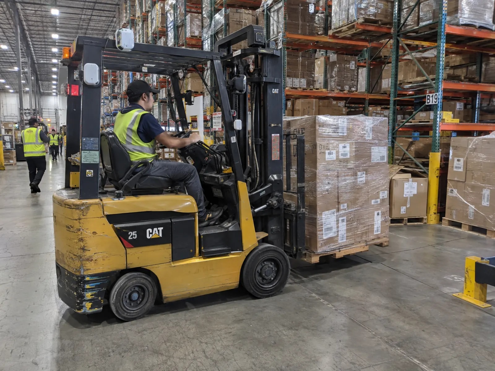
倉庫と物流団地
自動倉庫の通路、ヤードと荷役エリア。フォークリフトとパレットにタグを付け、同じ地図で見ます。
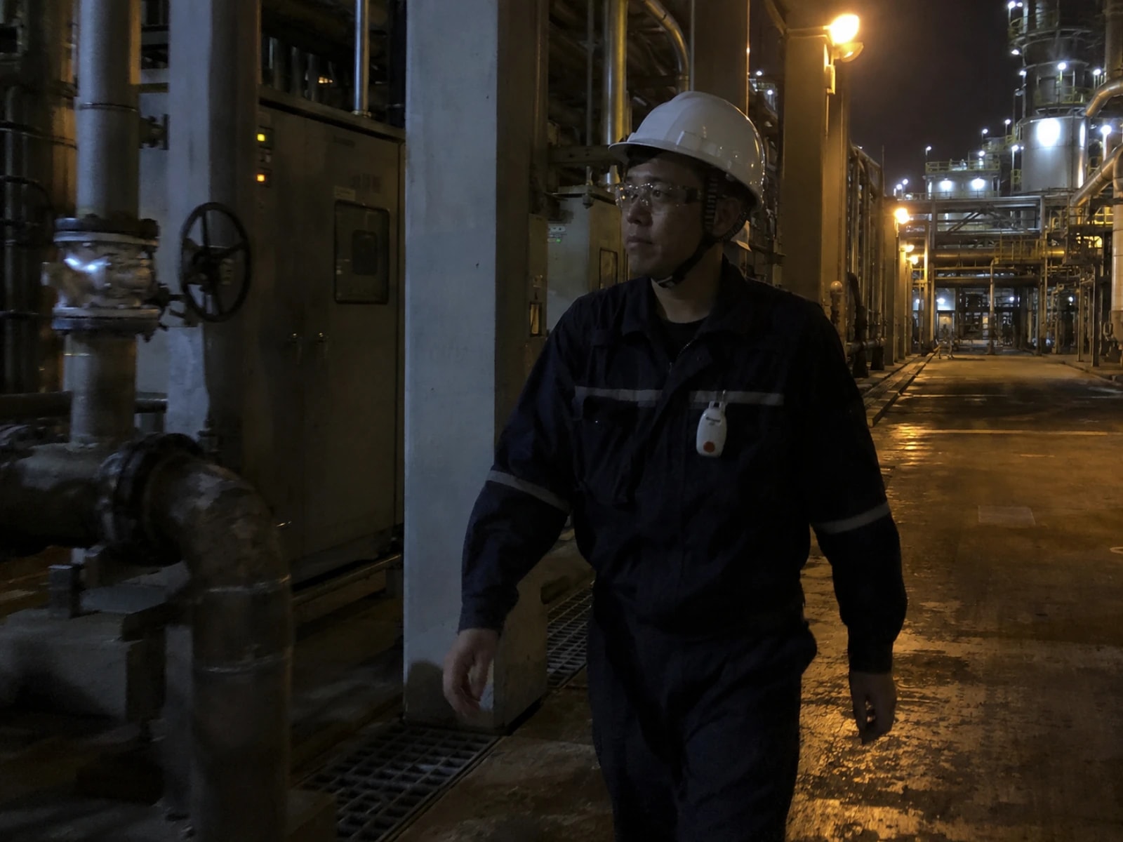
工場の巡回点検と単独作業
化学工場の巡回ルート、夜勤の受変電室。SOS ボタン付きの名札が、経路と時刻を自動で記録します。
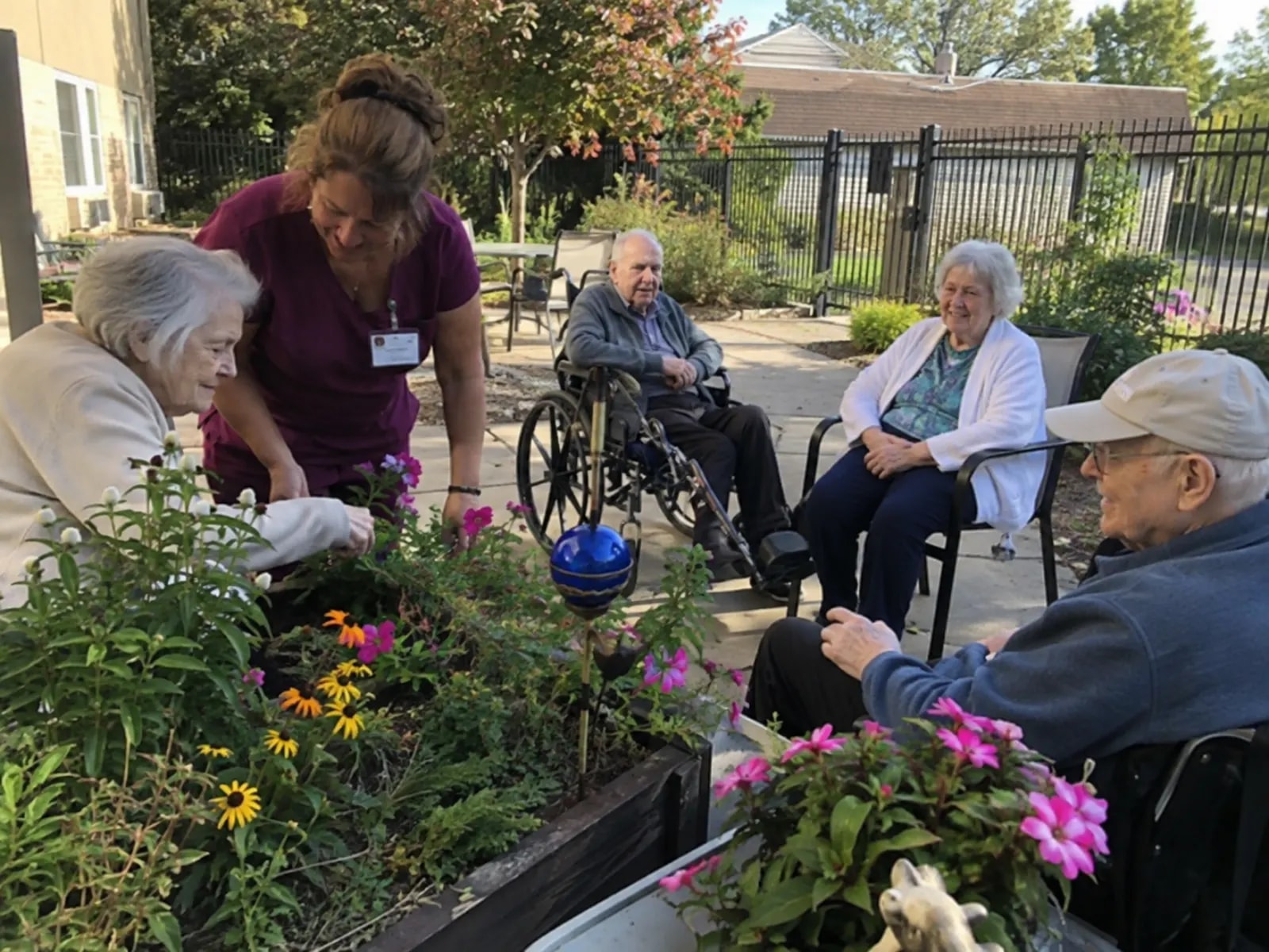
介護施設と事業所の外周
介護施設の活動エリア、工場の塀沿い。安全区域に沿ってジオフェンスを引き、出入りで警報を出します。
適さない条件:位置の欠落が人の安全に影響する用途。この設計は安全認証を取得していません。位置はタグの送信周期で更新され、屋内の精度はビーコンの配置に依存します。ビーコン、トラッカー、ゲートウェイは同じ周波数帯である必要があります。
どう実現するか
壁に設置した BC03 BLE ビーコンと携帯する SenseCAP T1000 トラッカーが位置データを取得し、SenseCAP M2 LoRaWAN ゲートウェイ経由で自社運用の測位サービスへ送ります。
現場にあるのは 3 種類のデバイスだけです。屋内の位置を示すビーコン、人が携帯するか資産に取り付けるトラッカー、そして上りデータを集める LoRaWAN ゲートウェイです。ゲートウェイより先はすべて自分でホストするソフトウェアで、測位アプリケーションは Docker イメージとして提供され、ダッシュボードはそのアプリが配信するページです。
定位タグ
現場の規模に応じて数が増えるのはこの 2 種類だけです。**BLE ビーコン(BC03)**は壁に貼り付ける電池駆動の屋内位置基準で、T1000 トラッカーは屋内ではビーコンをスキャンし、屋外では自身の GNSS を使います。GNSS のみでカバーできるエリアにはビーコンは不要です。
| 項目 | 標準値 | 出典 |
|---|---|---|
| 屋内精度、1 ゾーンあたりビーコン 3 台以上 | 2〜3 m | BC03 wiki |
| 屋内精度、1 ゾーンあたりビーコン 1 台 | 室単位 | 同上 |
| 設置高さ/間隔 | 2.5〜3 m/5〜10 m | BC03 wiki 推奨間隔。金属製棚の周囲は密に配置 |
| ビーコン電池寿命 | 5 年以上 | BC03 wiki |
屋内精度を最も左右するのはビーコンの配置です。 上記 4 行はいずれも配置手法とデータシートに基づく標準値であり、本パッケージでの実測値ではありません。
LoRaWAN ゲートウェイ
ゲートウェイ 1 台が通信範囲内の全トラッカーの上りデータを集約し、ネットワークサーバーへ転送します。現場ですでに LoRaWAN を運用している場合、トラッカーは他のデバイスと同様に参加させるだけです。
| 項目 | 標準値 | 出典 |
|---|---|---|
| ゲートウェイ通信距離 | 見通しで最大 2 km | SenseCAP M2 データシート |
| ゲートウェイ 1 台あたりのトラッカー数 | 同一範囲内で 100〜200 台 | ゲートウェイの容量。上り送信間隔と地域により変動 |
周波数バリアントは現場の地域に合わせて選びます:US915、EU868、AS923 などは別 SKU であり、ゲートウェイとトラッカーの周波数を一致させる必要があります。両行とも標準値です。デプロイガイドでは SenseCAP OpenStream への接続と自前の ChirpStack 構築の両方を扱います。
測位サービス
自分で用意したホスト上で動作する Docker イメージで、ローカルに構築するか SSH 経由でリモートホストにデプロイします。アプリケーション、状態データ、ダッシュボードはすべて自分のネットワーク内にとどまります。トラッカーの上りデータは SenseCAP OpenStream または自前の ChirpStack を経由して届き、ブラウザや自分のシステムはこのホストに直接接続します。
インターネットが必要になり得るのは地図データだけです。 現場にインターネットがない場合はローカルの PMTiles アーカイブを構築し、導入前に一度ビルドして読み込みます。同梱の MQTT ブローカー設定は動作確認用であり、実運用では認証情報付きのブローカーに置き換えてください。データインターフェースは下記「取得できるデータ」を参照してください。
どこまでできるか
運用が始まったあと、当番の人がブラウザーで見て操作する画面。
実測データ
測位サーバー(reComputer J30 シリーズ、arm64)上で合成データを用いて測定した処理容量とレイテンシの基準値です。
| 指標 | 代表値 | 機器 | 選定の目安 |
|---|---|---|---|
| 200 タグ同時処理容量 | P95 828 ms(パケットロス 0%) | reComputer J30 シリーズ | 30 秒間隔送信、800 件の上りを連続処理する安定プロファイル |
| 50 タグ高頻度追跡 | P95 220 ms(パケットロス 0%) | reComputer J30 シリーズ | 2 秒間隔の高速更新、重要工程や動線のリアルタイム把握に最適 |
| SOS 緊急アラート配信 | P50 24 ms(P95 29 ms) | reComputer J30 シリーズ | 上り受信からフロントエンド WebSocket ブロードキャストまでの時間 |
タグが停止した場合、固定の 15 分しきい値でオフラインと判定されます。機器ごとの実測データとテスト条件は エンジニアリング Wiki · BLE & LoRaWAN 屋内外測位ソリューション を参照してください。
何が取り出せるか
導入後のインターフェースは次のとおりです。すべて測位ホストのポート 5173 で提供されます。
| インターフェース | エンドポイント | 内容 |
|---|---|---|
| WebSocket | ws://<host>:5173/ws | tracker_update:position は {x, y, coordSystem: "metric"} または {lat, lon, accuracy, coordSystem: "wgs84"}。tracker_checkin / tracker_position_detection は出入り時に geofence ブロックを追加。ほかに tracker_sos と tracker_offline |
| REST | GET/PUT /api/configuration/dashboard/maps/{mapName}/registration | 原点、回転、縮尺。管理者セッションが必要で、ゲストセッションは 403 を返します |
| REST | POST /api/geofences、POST /api/events | フェンスの形状(GeoJSON ポリゴン、または中心点と半径)と、それを参照するアラームルール |
| LoRaWAN 上り | SenseCAP OpenStream、または ChirpStack の MQTT トピック | フィールドの対応関係は導入ガイドに記載 |
屋内と屋外の判別は、緯度の有無ではなく座標系のフィールドで分岐してください。 このハードウェアでは精度フィールドが常に空のため、良好ではなく不明として扱います。geo モードでは、フェンス自身の「10 秒以内に 3 点」という確認条件が、アラームルールの時間範囲に代わって適用されます。
自社システムへの移植
再利用できる単位は「屋内測位」ではなく、「位置の基準 → LoRaWAN 上り → 座標の解決 → ジオフェンスのルール → イベント出力」というチェーンです。BLE に紐づくのは 1 区間だけ —— 観測したビーコンの集合をどう位置に変換するかです。それ以降は、緯度経度がどこから来たかに関係なく動きます。
| レイヤー | 移植時に必要な作業 |
|---|---|
| LoRaWAN の join、上りデータの取り込み、ChirpStack / OpenStream アダプタ | そのまま再利用 |
| フロアプランのジオリファレンス(原点、回転、縮尺) | そのまま再利用 |
| ジオフェンスエンジン:WGS84 のポリゴンと円、出入り、3 点確認 | そのまま再利用 |
| WebSocket 配信、ダッシュボード、オフライン検出 | そのまま再利用 |
| ビーコン集合 → 位置の解決 | 新しい基準方式向けに書き直す |
| 屋内/屋外のヒステリシスしきい値 | 新しい根拠データに合わせて 再調整 |
形の似たデザインは同じ範囲に入ります:エリア入場による出退勤、巡回ルートの記録、コールドチェーンやヤードの滞留時間ルール、そして「あるべき場所から出たか」を判定するアラーム全般。
適さない形態
- サブメートル級や棚単位の精度。 BLE の RSSI 三辺測量では分解できません。UWB は別の無線方式であり、しきい値の違いではありません。
- 秒単位の追跡。 鮮度は上り送信間隔で決まり、その間隔は LoRaWAN のデューティサイクルで決まります。
- 位置の欠落を「何も動いていない」根拠にする用途。 上りデータは欠落し得るもので、本デザインは安全認証を持ちません。
どう導入するか
現場の状況をお聞かせください。ハードウェアはこちらで選び、その後データ接続と手順に進みます。
構成を選ぶ
現場の状況をお聞かせください。ハードウェアはこちらで選びます。
室内面積
メートル級の測位が必要な屋内床面積はどれくらいですか?ビーコン数は追跡対象の数ではなく床面積で決まります。ヤード・構内道路・駐車場は GNSS でカバーされ、ビーコンは不要です。
構成を選ぶ
現場の状況をお聞かせください。ハードウェアはこちらで選びます。
Starter Kit
屋内 500 m² までをメートル級でカバーします。屋外の追跡、ジオリファレンス、ジオフェンスは T1000 内蔵の GNSS でまかなうため、ハードウェアの追加費用はかかりません。
硬件/物料名称 数量 型号/SKU 说明 SenseCAP BC03 屋内 Bluetooth ビーコン 9 100085893 - SenseCAP LoRaWAN カード型トラッカー T1000-A trackers 114993073 - SenseCAP M2 LoRaWAN 屋内ゲートウェイ 1 114992981 - Standard Setup
BC03 の推奨間隔 5〜10 m の範囲内、7.5 m グリッドで 1250 m² をメートル級にカバーするビーコン 23 台。イメージも機能も他の 2 つと同じで、違うのはビーコンとトラッカーの数だけです。
硬件/物料名称 数量 型号/SKU 说明 SenseCAP BC03 屋内 Bluetooth ビーコン 23 100085893 - SenseCAP LoRaWAN カード型トラッカー T1000-A trackers 114993073 - SenseCAP M2 LoRaWAN 屋内ゲートウェイ 1 114992981 - Enterprise
大規模構内や複数フロアの施設向けに、2000 m² 想定のビーコン 36 台。超過分は 56 m² ごとに 1 台追加します。金属棚の周囲ではビーコンを増やしてください。ゲートウェイ 1 台の公称見通し距離は 2 km のままなので、2 台目が必要かどうかはカバー範囲の問題であり、容量の問題ではありません。
硬件/物料名称 数量 型号/SKU 说明 SenseCAP BC03 屋内 Bluetooth ビーコン 36 100085893 - SenseCAP LoRaWAN カード型トラッカー T1000-A trackers 114993073 - SenseCAP M2 LoRaWAN 屋内ゲートウェイ 1 114992981 -
自分で比べる:各構成のスペック対照デプロイガイド · 60min →
パッケージ別ハードウェア一覧
| 構成 | 役割 | 機材 | 数量 |
|---|---|---|---|
| スターターキット | LoRaWAN Gateway | SenseCAP M2 マルチプラットフォーム LoRaWAN 室内ゲートウェイ | 1 |
| BLE Beacons | SenseCAP BC03 Indoor Bluetooth Beacon | 9 | |
| T1000 Tracker | SenseCAP T1000 LoRaWANカード型トラッカー | 1 | |
| スタンダード構成 | LoRaWAN Gateway | SenseCAP M2 マルチプラットフォーム LoRaWAN 室内ゲートウェイ | 1 |
| BLE Beacons | SenseCAP BC03 Indoor Bluetooth Beacon | 23 | |
| T1000 Tracker | SenseCAP T1000 LoRaWANカード型トラッカー | 3 | |
| エンタープライズ | LoRaWAN Gateway | SenseCAP M2 マルチプラットフォーム LoRaWAN 室内ゲートウェイ | 1 |
| BLE Beacons | SenseCAP BC03 Indoor Bluetooth Beacon | 36 | |
| T1000 Tracker | SenseCAP T1000 LoRaWANカード型トラッカー | 10 |
技術仕様・実装パスの比較
| プリセット | 屋内面積 | ビーコン | トラッカー | 適する現場 |
|---|---|---|---|---|
| Starter Kit ⭐ | 500 m² まで | 9 | 1 | 小規模オフィス、まず一式動かしたい場合 |
| Standard Setup | 500〜2000 m² | 23(1250 m² 想定) | 3 | 中規模倉庫、工場フロア |
| Enterprise | 2000 m² 以上 | 36(2000 m² 想定) | 10 | 大規模構内、複数フロアの施設 |
3 つとも同じアプリケーションイメージ、同じ機能セットです。屋外の追跡、ジオリファレンス、ジオフェンスは T1000 内蔵の GNSS で動くため、追加のハードウェアは不要です。 プリセットの違いはビーコンとトラッカーの数、つまりメートル級でカバーする屋内床面積だけです。ビーコン数は 7.5 m グリッド(BC03 の推奨間隔 5〜10 m の中央値)を前提に、1 台あたり約 56 m²、床面積 ÷ 56 の切り上げで算出し、1 エリアあたり 3 台を下回らないようにします。より広い現場では 56 m² ごとに 1 台追加します。
どのプリセットでも LoRaWAN ゲートウェイが 1 台 必要です。設置地域に合った周波数バリアントを選んでください。難易度は 中級、導入手順は 7 ステップ、上流の目安は約 60 分 です。
よくある質問
エリア・部屋レベル(約 2〜5 m 精度)の近接測位に最適化されています。
- 測位方式:BLE ビーコンの電波強度(RSSI)に基づくフィンガープリンティングおよび近接判定を採用
- 更新間隔:ビーコンの発信間隔(既定 1〜3 秒)および LoRaWAN アップリンク周期に応じた準リアルタイムな動線把握が可能です。
ローカル LoRaWAN ネットワークサーバー構成であれば、完全閉域網で稼働します。
- 自立構成:ビーコン信号を受信した LoRaWAN 測位トラッカー、構内ゲートウェイ、ローカル ChirpStack、測位エンジンがすべて構内 LAN で完結します。
屋内構造によりますが、1 台の LoRaWAN ゲートウェイでビル 3〜5 フロアをカバー可能です。
- 電波透過性:Sub-GHz 帯(920 MHz 帯)の優れた透過力により、コンクリート壁や床を貫通して広範囲をカバー
- 見通し環境:工場や倉庫などの大空間であれば、1 ゲートウェイで数万平米をカバーできます。
発信周期や電波出力の設定により、ボタン電池 1 個で約 1.5〜3 年間稼働します。
- 省電力設計:Bluetooth Low Energy(BLE)の超低消費電力プロトコルを採用
- 管理機能:バッテリー残量はアドバタイズパケットに含まれ、ダッシュボード上で残量低下アラートを一括監視できます。
MQTT ブローカーまたは REST API を介して上位システムと容易に連動できます。
測位エンジンが出力する JSON メタデータ(タグ ID、現在エリア、滞在時間、最終検知時刻)を既存の WMS(倉庫管理)や MES(製造実行システム)へ直接流し込めます。
屋外 GPS と屋内 BLE を自動切り替えするハイブリッドトラッカーに対応しています。
屋外では衛星測位(GPS / GNSS)で広域位置を取得し、屋内に入ると自動的に BLE ビーコン測位へ移行するシームレスなトラッキングが可能です。
簡易近接モードであれば数時間、高精度マップ校正でも 1〜2 日で完了します。
- 部屋単位の近接方式:各部屋や通路にビーコンを配置し、マッピングテーブルを登録するだけで即日稼働
- RSSI マップ方式:現場を歩きながら電波強度マップをサンプリング登録します。
国内で使用する場合は技術基準適合証明(技適マーク)を取得した機器の選定が必須です。
- 電波法準拠:Seeed Studio が提供する LoRaWAN ゲートウェイおよびトラッカーは国内技適対応モデル(AS923 / 920 MHz 帯)を用意しています。
お探しの答えが見つかりませんか?
お問い合わせ
ハードウェアパートナーとしてうれしいです!